How satellite observations and verified field evidence combine to create dependable agricultural intelligence for programmes, policy and investment.

The Imperative for Robust Agricultural Evidence
The global agricultural landscape is dynamic, influenced by a myriad of factors from climate patterns to market forces. For governments and institutions, understanding this complexity with precision is paramount. The World Bank underscores that agriculture does more than feed people; it drives economic growth and poverty reduction, supporting millions of jobs. However, the sector is often constrained by a lack of infrastructure, counterproductive policies, and financial risks, while also being vulnerable to conflict, economic shocks, and extreme weather. To navigate these challenges and capitalize on opportunities, decision-makers require accurate, verifiable data. This evidence informs critical decisions on food security strategies, resource allocation, investment in sustainable practices, and the effectiveness of agricultural support programs. Without a robust evidence base, interventions risk being misdirected, inefficient, or even counterproductive, hindering progress towards global food and nutrition security goals.
Unlocking Insights with Satellite Intelligence
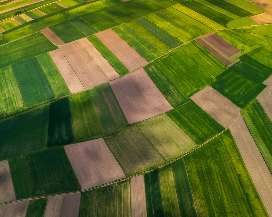
Satellite intelligence has revolutionized our capacity to monitor agricultural activities across vast and often remote areas. By leveraging remote sensing technologies, satellites can provide broad-scale insights into crop health, land use changes, water availability, and vegetation indices over time. This capability allows for the identification of trends, early detection of potential issues like drought or disease outbreaks, and the assessment of agricultural performance at regional or national scales. The efficiency of satellite data collection significantly reduces the time and cost associated with traditional field surveys, making it a powerful tool for initial assessments and continuous monitoring. It offers a bird's-eye view that can highlight areas of interest or concern, guiding more targeted interventions. However, while powerful, satellite data inherently possesses limitations, such as resolution constraints, susceptibility to cloud cover, and an inability to directly confirm specific ground conditions like soil composition, pest infestation levels, or precise yield figures.
The Indispensable Role of Ground Truth Data
While satellite intelligence provides invaluable broad strokes, ground truth data offers the critical detail and verification necessary to complete the picture. Ground truth refers to direct observations, measurements, and verification conducted on the ground, within the agricultural fields themselves. This data can include precise crop yields, soil nutrient analysis, identification of specific crop varieties, assessment of pest and disease presence, and documentation of actual farming practices. Its importance lies in its ability to validate and calibrate satellite observations, providing the granular detail that remote sensing alone cannot capture. Ground truth data ensures that the interpretations derived from satellite imagery are accurate and contextually relevant, building trust and credibility in the overall evidence base. It transforms broad satellite trends into specific, actionable insights, making it an indispensable component for dependable agricultural evidence.
The Synergy: Integrating Satellite and Ground Truth for Enhanced Accuracy
The true power in building dependable agricultural evidence emerges from the synergistic integration of satellite intelligence and ground truth data. This combined approach leverages the strengths of each methodology while mitigating their individual limitations. Satellite data can efficiently identify large-scale patterns and anomalies, pinpointing specific areas that warrant closer examination. Ground truth data then steps in to provide the detailed, on-the-ground validation and deeper context for these areas of interest. This creates an iterative feedback loop: satellite data guides efficient ground sampling, and the ground truth data, in turn, refines and improves the accuracy of satellite-derived models and analyses. The result is a comprehensive and highly reliable dataset that offers a far more complete and accurate understanding of agricultural conditions than either source could provide independently. This integrated approach is crucial for developing robust evidence that can withstand scrutiny and support high-stakes decisions.
Operationalizing Dependable Evidence with Integrated Systems
For governments and institutions managing complex agricultural programs, the effective integration of satellite and ground truth data requires structured workflows and robust platforms. A system designed for this purpose can centralize and streamline the entire process of evidence generation. For instance, a platform like CONSAI Agro & Energy OS can organize the demand for agricultural evidence, ensuring that all data collection efforts are aligned with specific objectives. It can structure the collection of both satellite-derived insights and ground truth observations, providing a clear framework for data input and management. Furthermore, such a system can define and track roles, assigning responsibilities for data collection, analysis, and verification to relevant personnel. This ensures accountability and transparency throughout the evidence-building process. Finally, it facilitates systematic follow-up actions based on the generated evidence, enabling continuous monitoring and adaptive management. By organizing these critical workflows, integrated systems support informed decision-making, enhance the traceability of data, and provide a transparent audit trail for all agricultural evidence, without replacing the expertise of engineers, verifiers, or the authority of regulatory bodies.
Strategic Implications for Government and Institutions
The availability of dependable agricultural evidence, forged through the integration of satellite intelligence and ground truth, carries profound strategic implications for governments and institutions. Such evidence empowers policy-makers to formulate more effective and targeted agricultural policies, ensuring that support reaches those who need it most and promotes sustainable practices. It enables more precise resource allocation, optimizing investments in infrastructure, technology, and farmer support programs. For instance, the World Bank's efforts to repurpose agricultural support in over 40 countries to achieve better outcomes, from healthier soils to more efficient distribution of seeds and fertilizer, directly benefits from such granular insights. Moreover, this integrated data enhances risk management capabilities, allowing for proactive responses to food security threats and climate-related challenges. By providing a clear, verifiable picture of agricultural realities, it strengthens accountability, improves the assessment of project impacts, and ultimately contributes to achieving broader development goals, including the World Bank's aim to strengthen food and nutrition security for hundreds of millions of people by 2030.
Key operational takeaways
- Reliable agricultural evidence is critical for effective policy, investment, and sustainable development, addressing challenges like increasing food demand and climate impacts.
- Satellite intelligence offers broad-scale, efficient monitoring of agricultural trends and anomalies, identifying areas of interest remotely.
- Ground truth data provides essential on-the-ground validation and granular detail, confirming and enriching satellite observations.
- Integrating both satellite and ground truth creates a robust, verifiable evidence base, enhancing accuracy and confidence in agricultural insights.
- Structured platforms can organize the workflow for collecting, managing, and utilizing integrated data, ensuring transparency and accountability.
- Dependable agricultural evidence empowers governments and institutions to make informed decisions, optimize resource allocation, and manage risks effectively.
Frequently asked questions
Why is ground truth data so important if satellites can cover vast areas?
While satellites provide broad coverage and identify trends, ground truth data is crucial for validation and detail. It confirms what satellites observe, providing specific information on factors like actual crop yields, soil health, pest presence, and local farming practices that remote sensing cannot directly measure, ensuring accuracy and context.
How can governments and institutions effectively implement this integrated approach?
Effective implementation involves developing clear data collection protocols, investing in both satellite data acquisition and ground verification teams, and utilizing integrated platforms. These platforms can centralize data, manage workflows, assign roles, and track follow-up actions, ensuring that the combined intelligence is systematically applied to decision-making.
What are the long-term benefits of building dependable agricultural evidence?
Long-term benefits include more resilient food systems, optimized resource allocation, improved food security, and more effective climate adaptation strategies. It enables better policy formulation, targeted investment, and enhanced accountability for development initiatives, ultimately contributing to sustainable economic growth and poverty reduction.
Source framework
This insight is supported by the following external reference material and CONSAI Agro & Energy OS operational context.
Dependable agricultural intelligence begins when remote observations, field records and review responsibilities remain connected.
Turn insight into a relevant platform pathway.
Choose the role and operating route that best matches your next step.